Democracy Monument
On Ratchadamnoen Klang Avenue, the monument commemorates Thailand’s 1932 political change and forms a key axis of modern Bangkok.
Search this destination on Google Maps ↗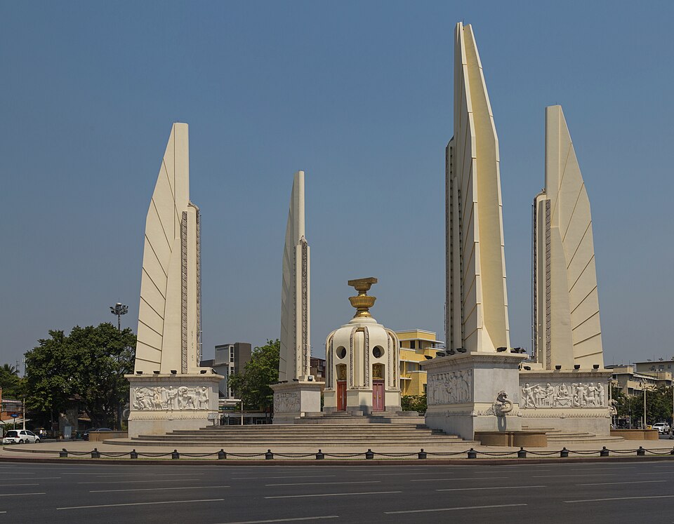
Explore this destination
On Ratchadamnoen Klang Avenue, the monument commemorates Thailand’s 1932 political change and forms a key axis of modern Bangkok.
About this site and its management
The monument stands within Bangkok’s public road system. Traffic management and access restrictions are subject to local authority arrangements.
Essential information
- Area
- Ratchadamnoen Klang Avenue, Phra Nakhon, Bangkok, Thailand
- Opening and access
- View from public pavements; do not enter roundabout
- Admission
- Free to view from surrounding pavements
- Getting here and location
- Democracy Monument
Background and significance
Built to commemorate the 1932 political transition, its four-wing design is aligned with Ratchadamnoen Avenue, connecting modern civic symbolism to city planning.
Architecture and what to notice
Study the monument’s four-part composition and its relationship to the avenue from safe sidewalks.
Visitor advice
It stands in a busy traffic circle: never enter the roadway or central island for a photograph.
Step-by-step walking route
- North-east Sanam Luang
- Ratchadamnoen Klang Avenue
- safe outer pavements around the monument
- return via designated crossings.
Where to take photos
Use permitted pavements on either side of Ratchadamnoen Avenue to compare its symmetry; do not enter the traffic island.
Getting here and location
North-east Sanam Luang → Ratchadamnoen Klang Avenue → safe outer pavements around the monument → return via designated crossings.
Search this destination on Google Maps ↗Where to stay nearby
For several Old Town stops, compare Phra Nakhon or MRT-connected accommodation based on your evening return plans.
Visitor reviews
Check the latest rating and authentic visitor experiences for this specific place on Google Maps.
Google Maps ↗Frequently asked questions
Is this directly on Sanam Luang?
This is a stop on an Old Town itinerary around the field. Exact walking distance and entrance depend on the destination; check the map pin before setting off.
How should I approach this place?
North-east Sanam Luang → Ratchadamnoen Klang Avenue → safe outer pavements around the monument → return via designated crossings.
What should I check on the day?
Confirm opening arrangements, access and any road or pier restrictions, especially during official ceremonies.
Related stops
An independent visitor guide to Bangkok Old Town